Mapping Medieval West African States
A discussion of how to teach the different borders of the medieval West African empires (Ghana/Wagadu, Mali, Songhay)
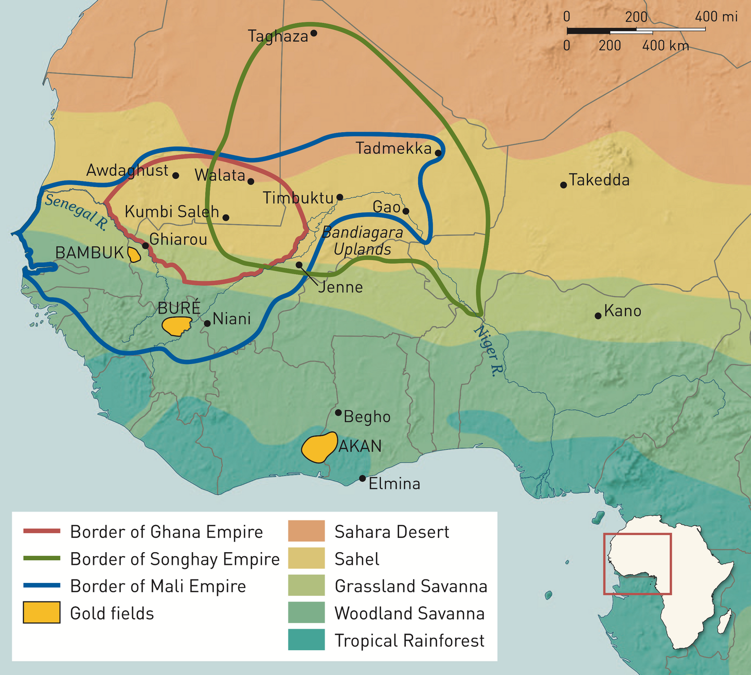
As I’ve been reading about the empires of Ghana, Mali, and Songhay, I’ve noticed a lot of differences in the maps of these empires. Each textbook and monograph seems to have surprisingly different borders for these states. I was thinking about how students might react to these differences. Most of our students have grown up in a world where political borders matter and states rigorously patrol their borders. They most likely don’t inuitively understand that borders used to be more fluid and permeable.
I found this helpful quote from Robert Harms in Africa in Global History with Sources:
Ghana, Mali, and Songhay were medieval empires that differed in significant ways from the modern states that populate the world today. Whereas border control is a hallmark of the modern state, the boundaries of medieval empires were only vaguely defined, and they expanded and contracted with the waxing and waning of power at the center. The kings sought to control their vassals through webs of personal relationships and economic ties rather than through legal or constitutional frameworks. Relationships with their vassals, allies, and enemies defined the empires more accurately than did notions of territorial integrity. In the sparsely populated Sahel, control of trading towns and agriculturally rich floodplains was far more important than dominion over vast expanses of semiarid land.
Using this quote and an assortment of maps, we can help students understand how premodern states differ from modern states. Premodern states rarely controlled territory or people in the way that modern states can. Rulers often relied on many informal means for maintaining order in locations far from the capital of the state. This approach means that the borders we see on these maps do not best represent the government’s actual degree of control over the territory.