Skip to content

Serio-Comic Maps, Nationalism, and the First World War

Drawing nationalism in 1914

Bram Hubbell
Bram Hubbell
2 min read
Serio-Comic Maps, Nationalism, and the First World War

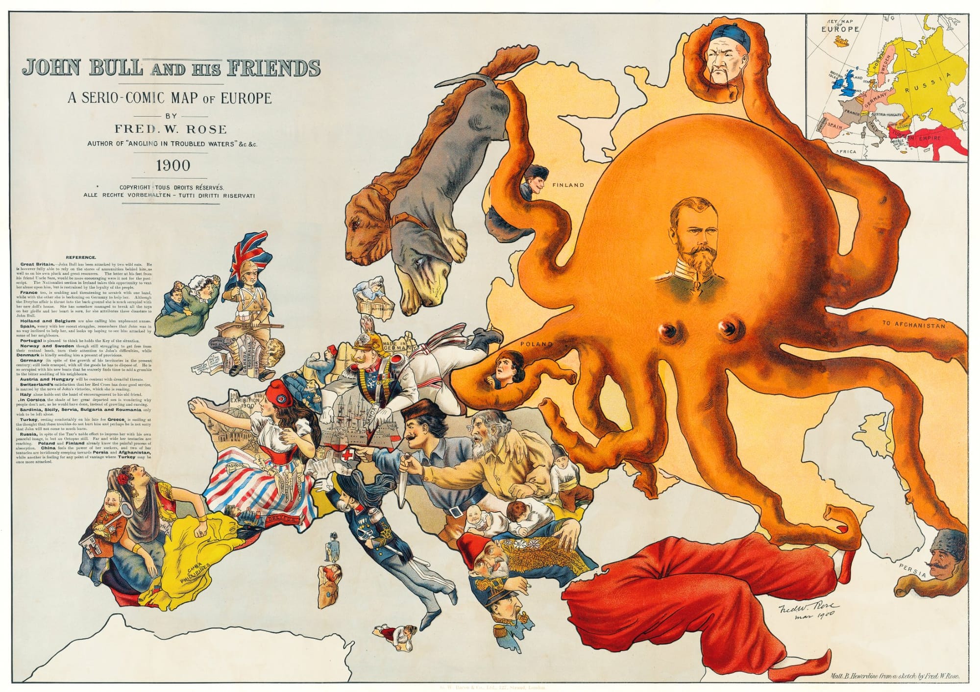
I always enjoyed using cartoons, images, and maps with students when teaching modern world history. One of my favorites is John Bull and His Friends from 1900. It’s a fun map that shows how nationalism influenced Europeans. Maps like this one were known as “Serio-Comic” maps.


Related Posts

Members Public

“ Sparks and Embers from the Raging Fires”: Experiencing Firebombing and Total War in Tokyo

Using survivor accounts to teach the firebombing of Tokyo

“ Sparks and Embers from the Raging Fires”: Experiencing Firebombing and Total War in Tokyo
Members Public

Greater East Asia and Second World War Propaganda

Teaching the East Asian theater of the Second World War using propaganda posters

Greater East Asia and Second World War Propaganda
Members Public

“A Situation of Complete Inertia and a Widespread Apathy”: Teaching Everyday Resistance to French Imperialism in Senegal in the 1920s and 1930s

What were the weapons of the weak in French Senegal?

“A Situation of Complete Inertia and a Widespread Apathy”: Teaching Everyday Resistance to French Imperialism in Senegal in the 1920s and 1930s